
Map showing the original boundaries of the historic cemeteries (dotted line) and how the site is divided today among the National Zoo, Rock Creek Park, and Walter Pierce Park. (Map by Mary Belcher, 2012)
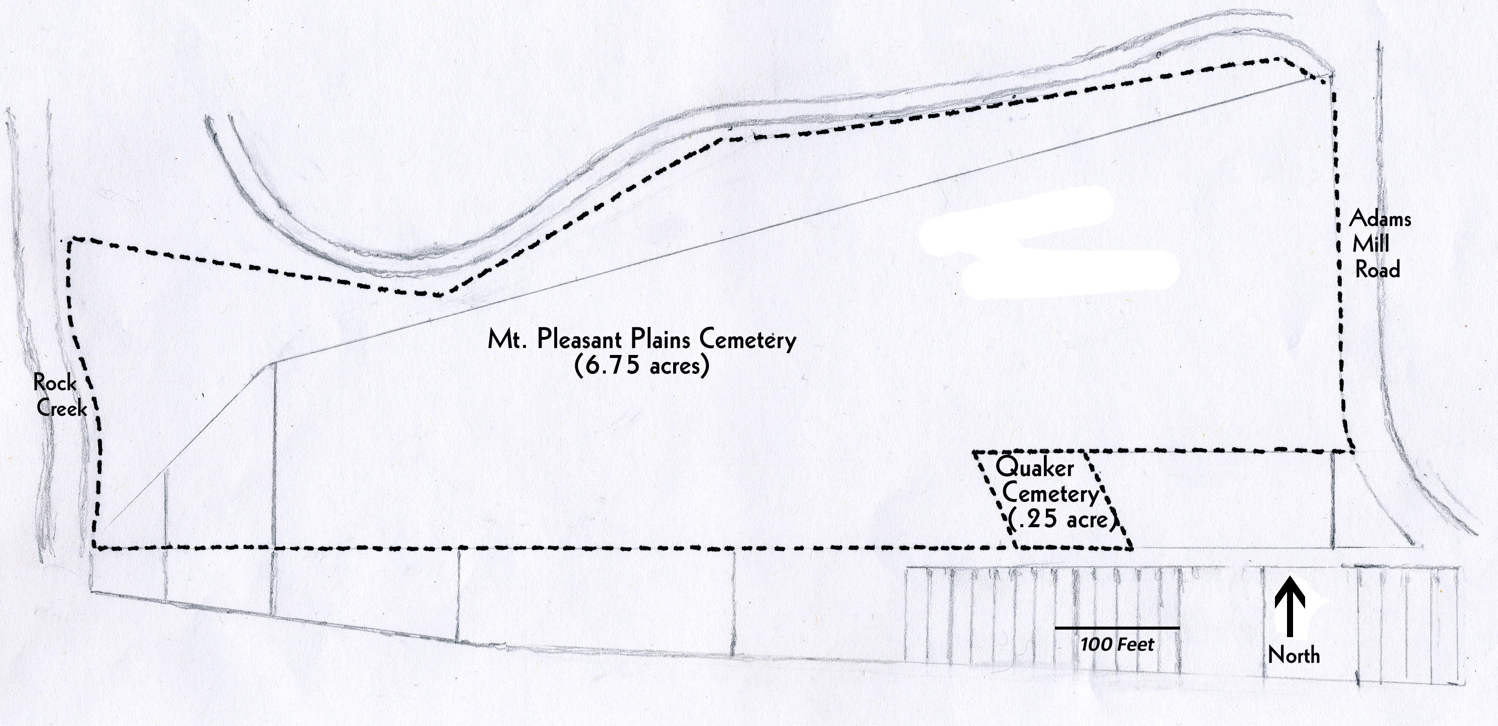
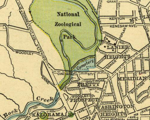
Map showing the Mt. Pleasant Plains and Quaker cemeteries site. (Map by Mary Belcher, 2012)
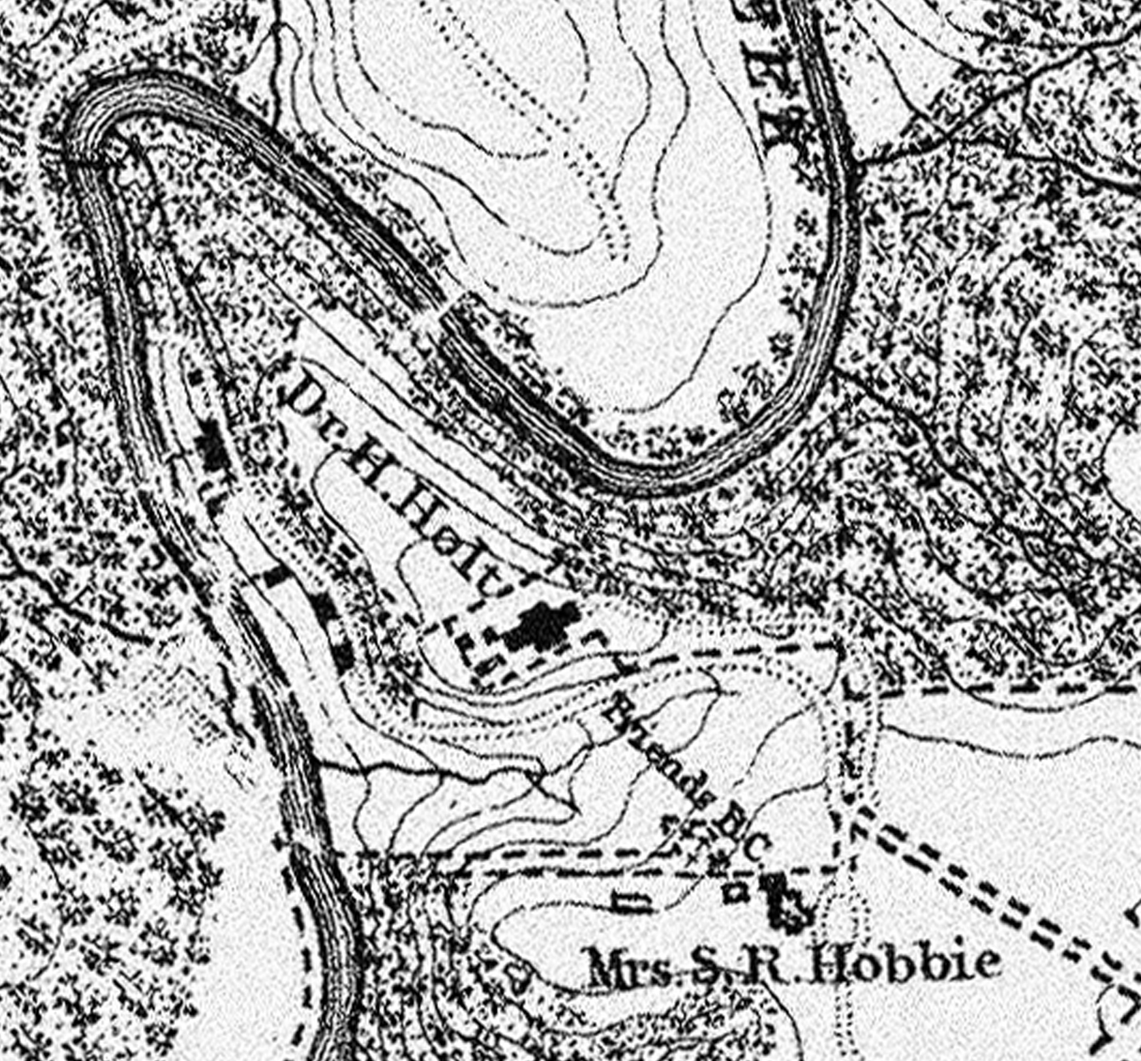
Late 1850s Boschke map showing the Friends (Quaker) Burying Ground, founded in 1807. This map was drawn before the much larger African American cemetery was established in 1870.
1866 Michler map showing fenced-in Quaker cemetery beneath the word “Cliffburne,” 14 years before the establishment of the larger African American cemetery at the site.
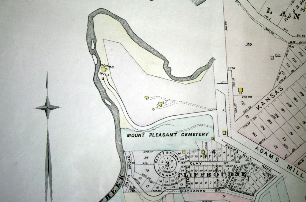
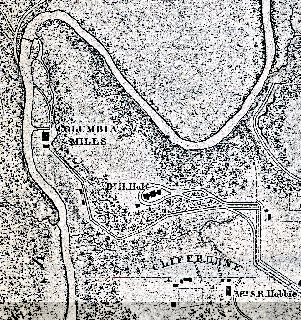
1887 map showing “Mount Pleasant Cemetery” and prospective neighborhood development south of the site.
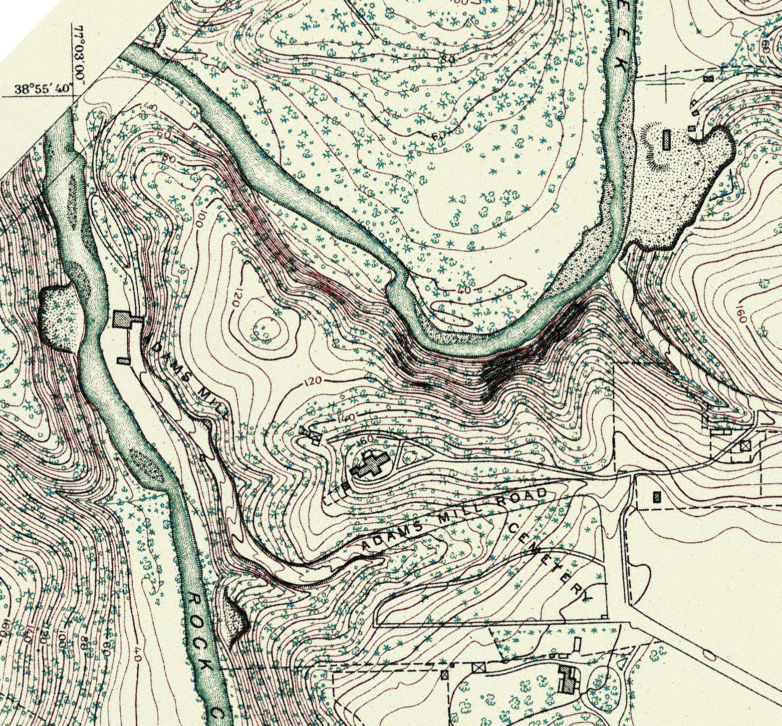
1888 U.S. Coast and Geodetic Survey map, just before the federal government in 1890 acquired the northern strip of cemetery land along the south side of Adams Mill Road for the new National Zoo. The map doesn’t show a delineation between the African American and Quaker cemeteries.

1888 U.S. Coast and Geodetic Survey map cropped to show cemetery site.
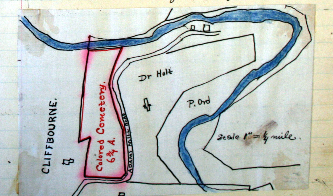
1890 map, oriented with West at the top, drawn by William Hornaday, a Smithsonian employee who scouted land for the creation of the National Zoo. He recommended that the Zoo purchase the entire African American cemetery, but he didn’t acknowledge the smaller Quaker cemetery.
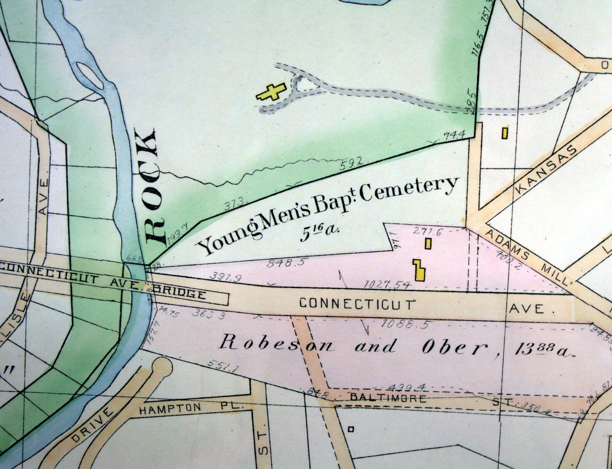
1894 Hopkins map showing some prospective streets and naming today’s Calvert Street as Connecticut Avenue; the cemetery is incorrectly labeled “Young Men’s Baptist Cemetery”–the name used by Zoo officials in acquiring part land in 1890.
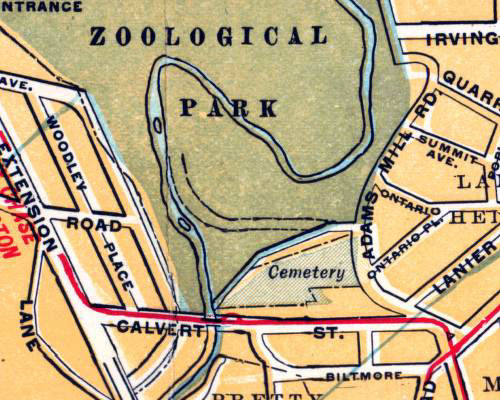
1901 map showing cemetery
1904 Baist’s map showing development along the southern side of the cemeteries on Calvert Street.
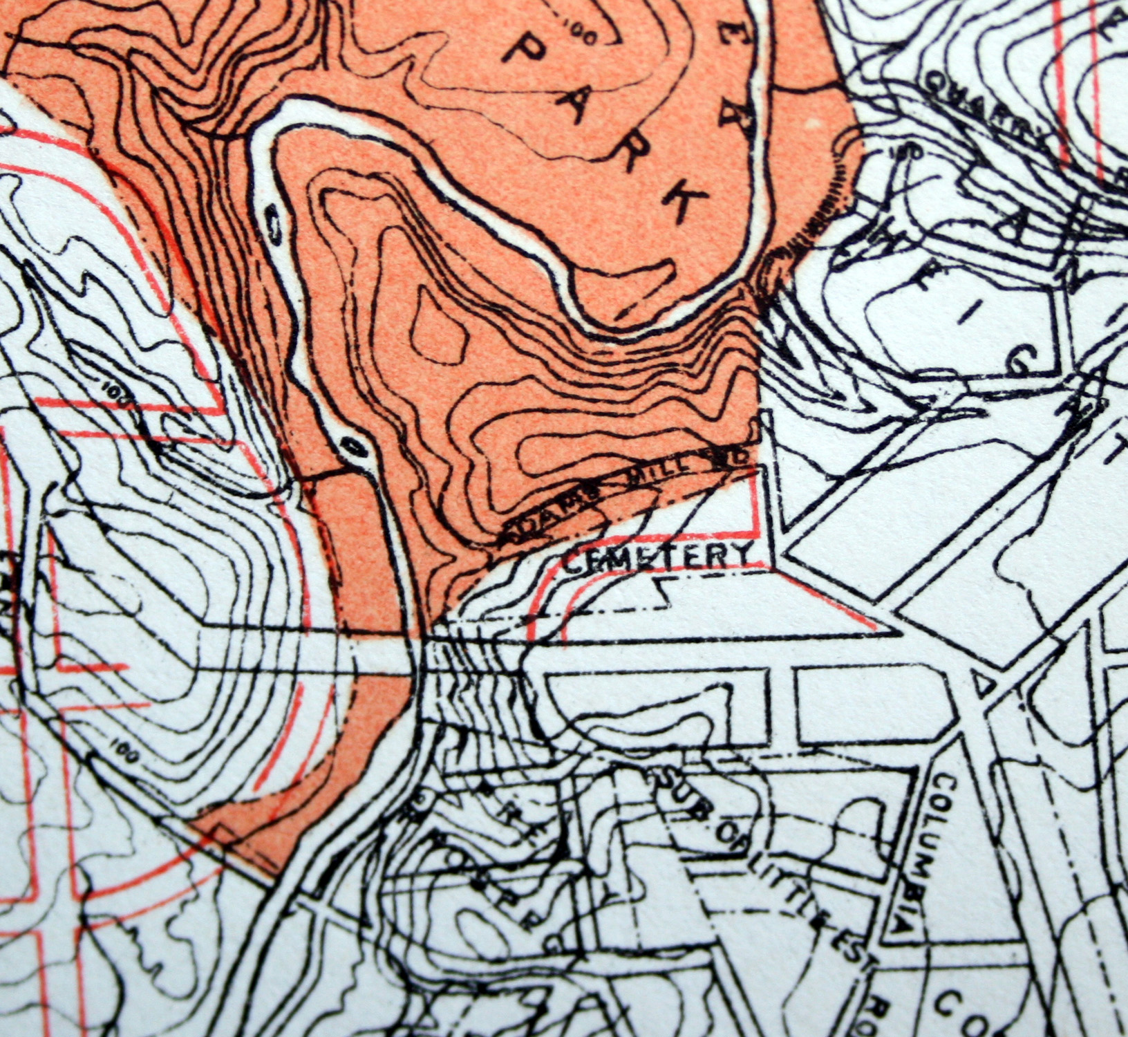
1907 map showing the land still marked as a cemetery, 17 years after the African American and Quaker cemeteries were closed.
1910 Foster & Reynolds map showing the land as a cemetery, even though burials had ceased in 1890.
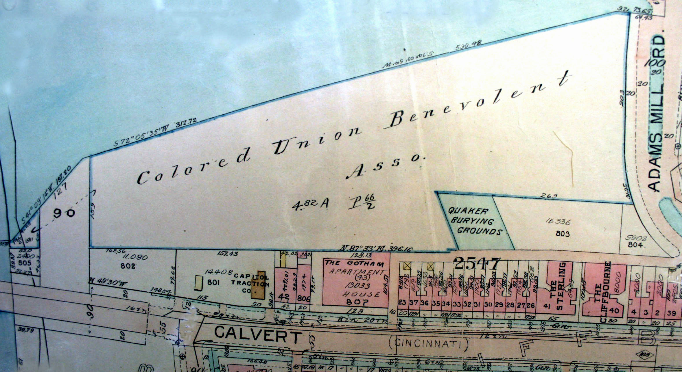
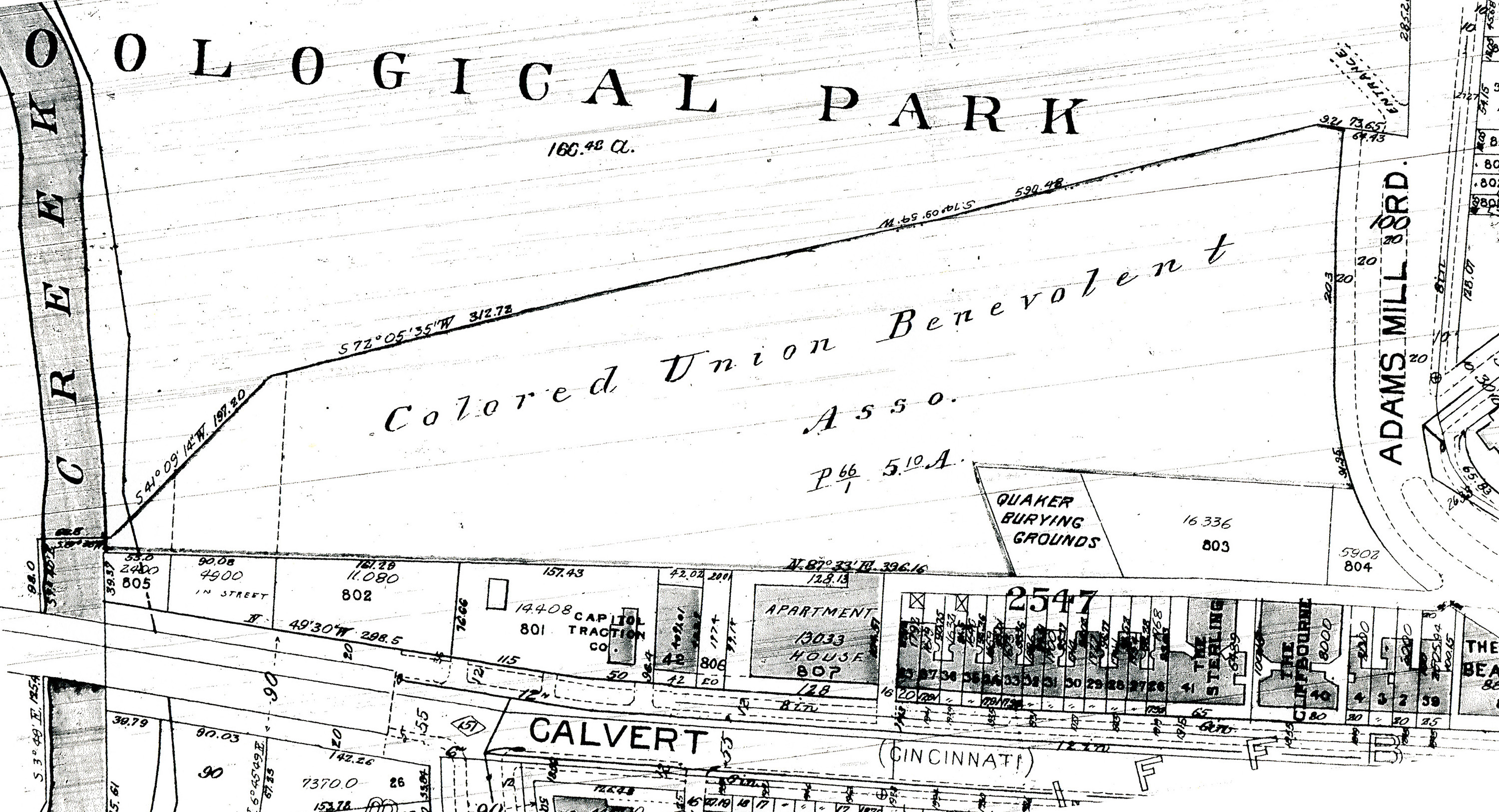
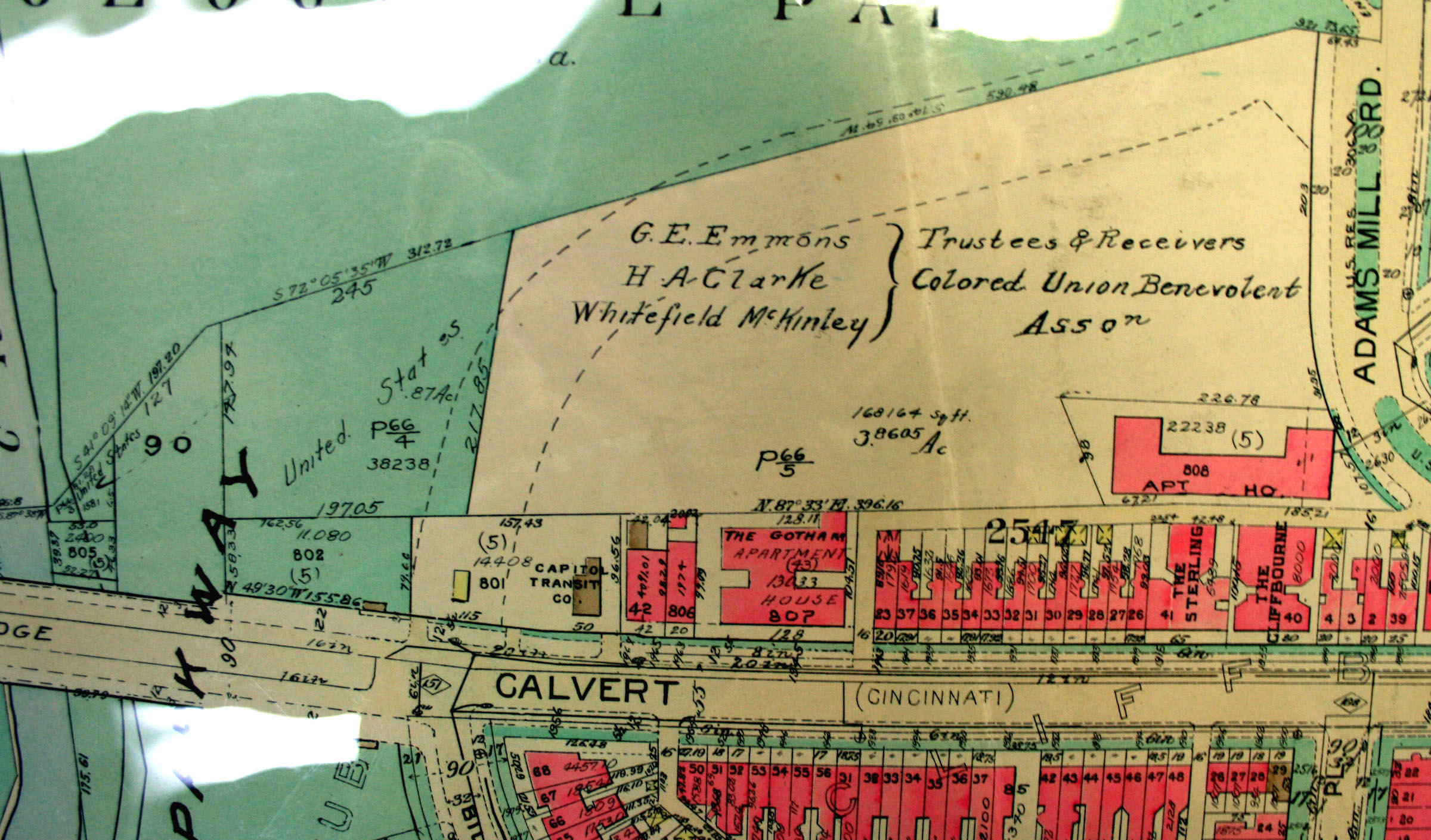
1919 Baist’s Real Estate map showing the cemetery land owned by the Colored Union Benevolent Association and the Quaker Burying Ground.
1931 Baist’s map showing at the east a close-up of land purchased in 1929 by the United States (National Park Service) to become part of the Rock Creek & Potomac Parkway.
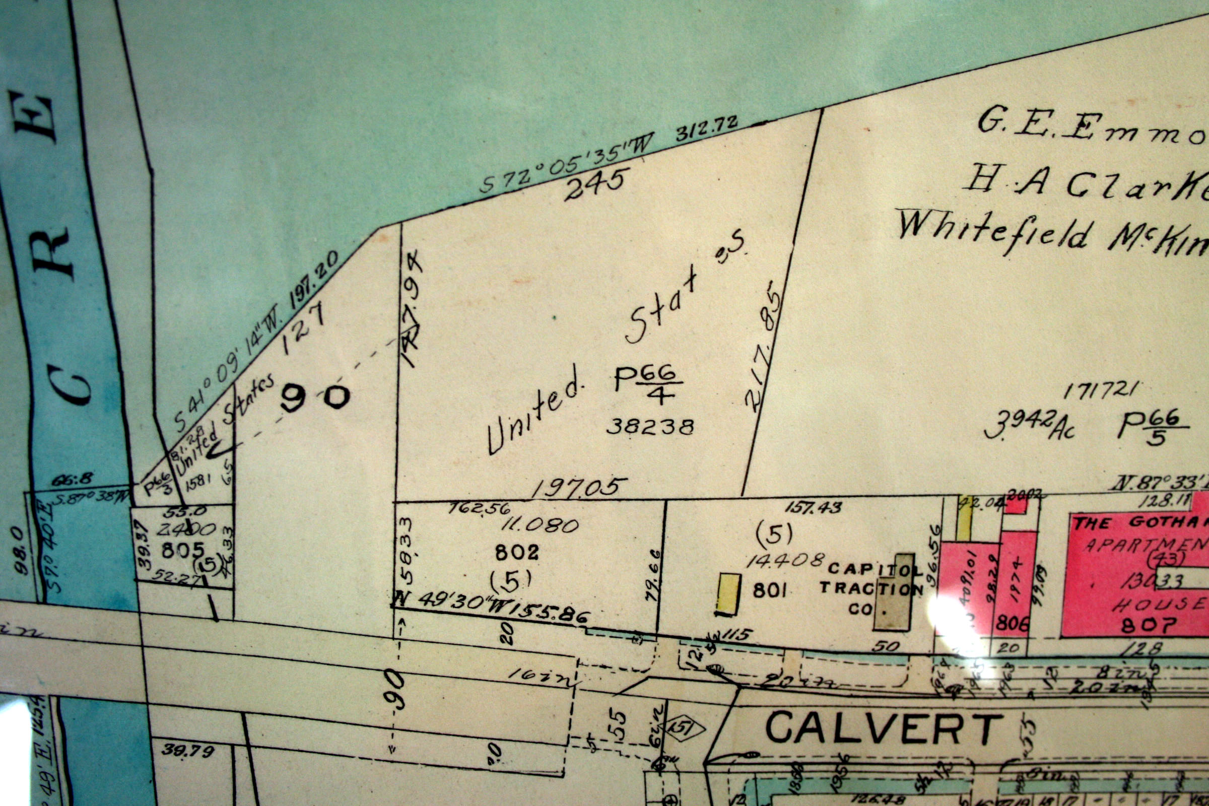
1937 Baist’s map, showing former cemetery land at west end purchased by the United States (National Park Service), and the eastern side owned by court-appointed trustees of the Colored Union Benevolent Association.

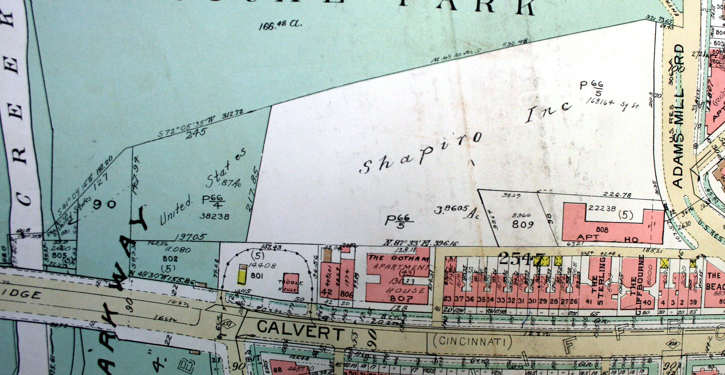
1945 Baist’s map showing former cemetery land after purchase by Shapiro Brothers developers. On the west is the former cemetery land purchased in 1929 by the United States (National Park Service).
1960 Baist’s Map showing the Quaker cemetery delineated again (marked “809”), after disappearing from earlier maps. Quakers successfully asked to have the map corrected.
